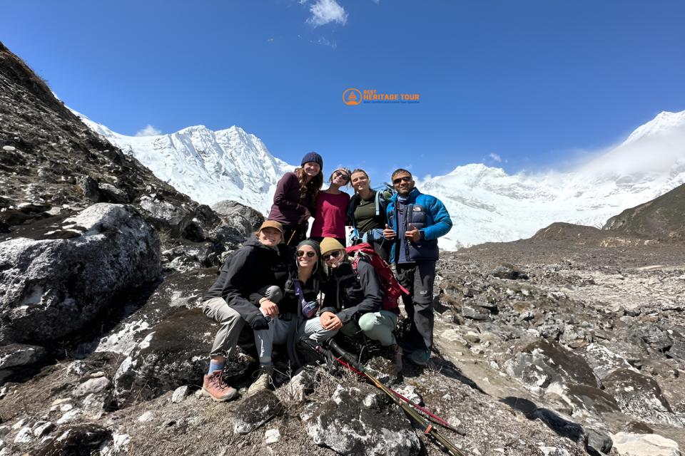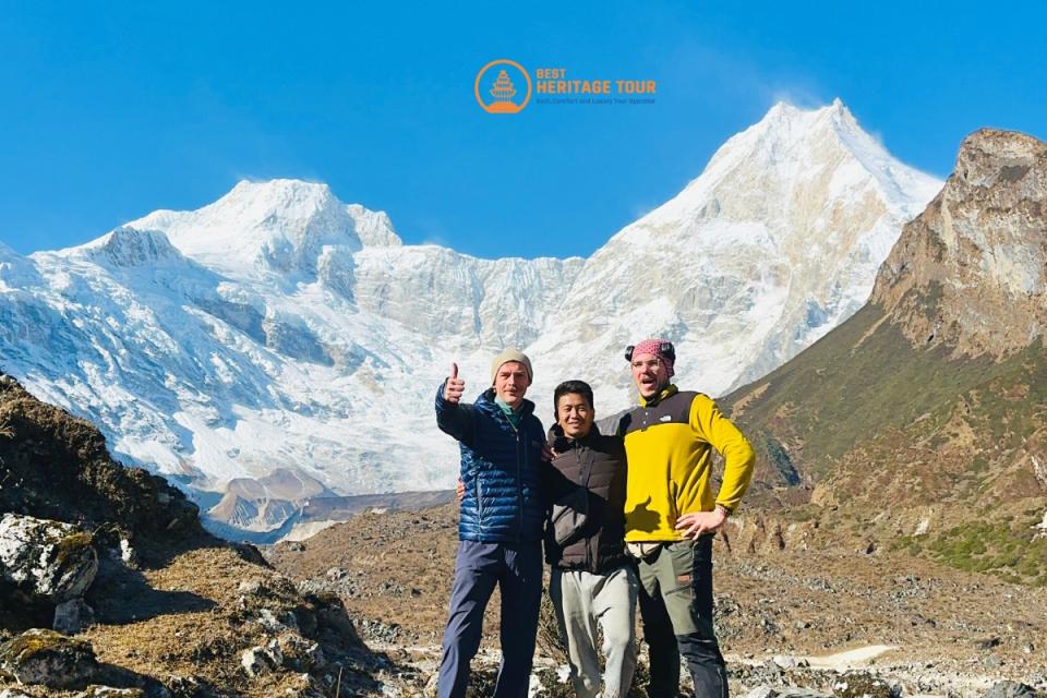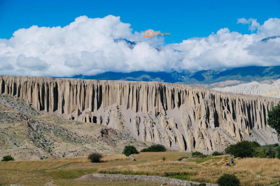
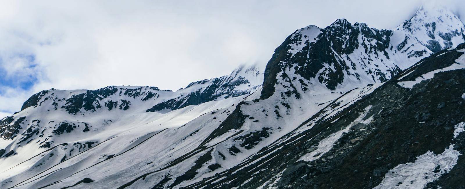
Circling the world’s eighth-highest peak, the Manaslu Circuit Trek in 2027 remains one of Nepal’s premier off-the-beaten-path mountain journeys. Bypassing the heavy trail traffic of neighboring Annapurna and Everest, this restricted-area trek offers an unblemished look at ancient Tibetan-Buddhist heritage, dramatic alpine valleys, and breathtaking wilderness.
At Best Heritage Tour, our team brings years of field experience, local network connections, and high-altitude logistics expertise to ensure your trek is seamlessly organized, culturally rich, and safe. Whether you plan to embark on the Manaslu Circuit Trek Itinerary for March 2027 during the vibrant spring bloom or target the crisp autumn clear skies, this comprehensive guide breaks down everything you need to know to execute a successful Himalayan expedition.
Why Choose the Manaslu Circuit Trek in 2027?
As classic routes across the Himalayas undergo modern road expansion, the Manaslu Circuit Trek in 2027 stands out as a protected, high-grade sanctuary.
-
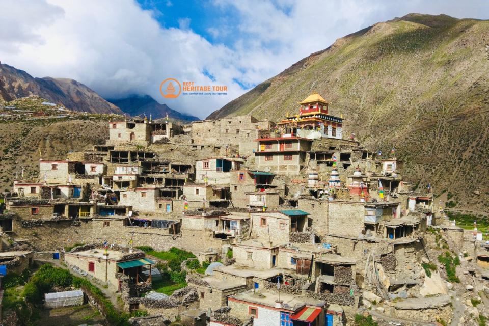
Preserved Cultural Authenticity: The high valley of Nubri retains traditions unchanged for centuries. You will walk past ancient mani walls, prayer wheels, and centuries-old monasteries like Ribung Gompa.
-
Controlled Trail Density: Because the Government of Nepal classifies the Manaslu region as a restricted zone, entry numbers are strictly regulated. You won't face the crowded suspension bridges or packed teahouses typical of other regions.
-
Extreme Geographic Diversity: Starting at an altitude of 760 meters in Machakhola, the trail moves through subtropical sub-Himalayan rainforests, massive granite gorges, alpine pine belts, and arctic glacial zones, topping out at the Larkya La Pass (5,106 m / 16,751 ft).
Detailed 12-Day Manaslu Circuit Trek Itinerary for 2027
Here is our best 12-day Manaslu Circuit Trek Itinerary for 2027, engineered to ensure smooth acclimatization and efficient logistics.
Day 1: Overland Drive from Kathmandu to Machakhola
Elevation: 1,400m to 760m (2,493 ft) | Distance: ~160 km | Drive: 7-8 hrs.
Your journey begins early in the morning from Kathmandu. Leaving the valley, we follow the Prithvi Highway along the Trishuli River before turning off towards Dhading Besi and Arughat. The final leg transitions into an off-road track following the Budhi Gandaki River to Machakhola, a lively hub of teahouses where we spend our first night.
Day 2: Trek from Machakhola to Jagat
Elevation: 760m to 1,300m (4,265 ft) | Distance: ~22 km | Trek: 6-7 hrs.
Crossing the Machakhola stream, the trail winds along narrow river gorges, passing through Tatopani (natural hot springs). We cross suspension bridges suspended high over the Budhi Gandaki and pass Dobhan and Yaruphant. After a final ascent up a stone staircase, we enter Jagat, the official entry checkpoint where our team validates your Restricted Area Permits.
Day 3: Trek from Jagat to Deng
Elevation: 1,300m to 1,860m (6,102 ft) | Distance: ~20 km | Trek: 6-7 hrs.
Ascending through terraced fields to Salleri and Sirdibas, the trail widens as we cross the long suspension bridge to Ghatta Khola. We walk past local water mills and enter Philim, a major Gurung village. Moving through bamboo and pine forests, we cross the river once more to reach Deng, signaling our entry into the upper cultural domain of Nubri.
Day 4: Trek from Deng to Namrung
Elevation: 1,860m to 2,630m (8,628 ft) | Distance: ~19 km | Trek: 6-7 hrs.
Today marks a noticeable transition into Tibetan cultural landscapes. We trek through deep gorges, crossing the Budhi Gandaki several times. The trail ascends steeply through rhododendron, oak, and fir forests. As we reach Namrung, you are greeted with your first stunning views of Mt. Manaslu (8,163 m), Kutang Himal, and Naike Peak.
Day 5: Trek from Namrung to Lho Gaon
Elevation: 2,630m to 3,100m (10,171 ft) | Distance: ~11 km | Trek: 4-5 hrs.
A short but scenic morning walk through the upper Nubri region. We pass through Lihi and Syala villages, where local residents wear traditional Chuba dresses. Lho Gaon is dominated by the majestic Ribung Gompa and provides one of the most magnificent sunrise and sunset viewpoints of Mount Manaslu's double peaks.
Day 6: Trek from Lho Gaon to Samagaon
Elevation: 3,100m to 3,500m (11,483 ft) | Distance: ~8 km | Trek: 3-4 hrs.
We follow the lateral moraine of Pungyen Glacier toward Samagaon. This is the main alpine hub of the Manaslu region. Sitting under the shadow of Mt. Manaslu, Samagaon features stone houses, long mani walls, and thousands of prayer flags flapping in the mountain breeze.
Day 7: Essential Acclimatization Day in Samagaon
Elevation: 3,500m (11,483 ft) | Active Rest.
To ensure proper altitude adaptation before crossing Larkya La Pass, we spend a crucial rest day in Samagaon. Options include a side excursion to Birendra Lake (3,450m) or an energetic hike up to Manaslu Base Camp (4,800m) for seasoned walkers. This active rest optimizes blood oxygenation for the high pass ahead.
Day 8: Trek from Samagaon to Samdo/Mishima
Elevation: 3,500m to 3,850m (12,631 ft) | Distance: ~16 km | Trek: 4-5 hrs.
Following the river valley through birch and juniper woods, the trail rises gently toward Samdo, a traditional village inhabited by Tibetan refugees just a few kilometers from the border. We spend the afternoon resting, drinking butter tea, and taking short elevation gains to acclimatize further.
Day 9: Trek from Samdo/Mishima to Dharmasala
Elevation: 3,850m to 4,460m (14,632 ft) | Distance: ~12 km | Trek: 4-5 hrs.
Leaving Samdo, we descend briefly to cross the wooden bridge over the Larke River before ascending past the ancient Larkya Bazaar trade post. The trail climb is slow and steady, taking us to Dharmasala (Larkya Phedi). We turn in early to prepare for the high-pass crossing tomorrow morning.
Day 10: High Pass Day - Dharmasala to Bhimthang via Larkya La Pass
Elevation: 4,460m to 5,106m (16,751 ft) to 3,720m (12,205 ft) | Distance: ~24 km | Trek: 8-10 hrs.
Our day starts long before dawn around 3:30 AM. A steady, cold incline leads across moraine ridges and past frozen alpine tarns. Reaching the Larkya La Pass (5,106 m) reveals panoramic views of Himlung Himal, Cheo Himal, Gyaji Kang, Kang Guru, and Annapurna II. After taking photos, we descend a steep, snow-covered moraine trail down to the grassy meadows of Bhimthang.
Day 11: Trek from Bhimthang to Goa
Elevation: 3,720m to 2,015m (6,610 ft) | Distance: ~16 km | Trek: 5-6 hrs.
Leaving high alpine terrain behind, we descend through dense forests of pine, oak, and blooming rhododendron along the Dudh Khola. Passing through Karche and Yak Kharka, we reach the peaceful village of Goa for our final evening on the trail.
Day 12: Trek from Goa to Tilije & Overland Drive to Kathmandu
Elevation: 2,015m to 1,500m to 1,400m | Trek: 2 hrs | Drive: 7-8 hrs.
A short downhill morning walk takes us through Tilije, across the Marsyangdi River to Dharapani. From here, our private 4WD vehicles pick us up for the scenic road journey through Besisahar back to Kathmandu, concluding our epic circuit.
Seasonal Insight: Manaslu Circuit Trek Itinerary for March 2027
Choosing the Manaslu Circuit Trek Itinerary for March 2027 places you right at the opening of the Himalayan spring season. Trekking during March provides distinct visual and physical advantages:
-
Rhododendron & Wildflower Blooms: Lower-to-mid elevations (from Jagat to Namrung) spring to life with brilliant crimson, pink, and white rhododendron forests.
-
Increasing Day Temperatures: Winter snow begins melting rapidly off lower tracks, offering warm, comfortable walking weather during the daytime.
-
Moderate Trail Traffic: March sits at the beginning of the spring surge, meaning high pass routes and teahouses are less occupied than during peak April or October months.
2027 Permit Requirements for Manaslu Circuit Trek
Because the Manaslu valley lies along the sensitive border zone with Tibet, trekking independently without a registered guide remains prohibited by the Ministry of Culture, Tourism, and Civil Aviation.
|
Permit Type |
Purpose / Region |
Issuing Authority |
|---|---|---|
|
Manaslu Restricted Area Permit (RAP) |
Required between Jagat and Samagaon |
Department of Immigration (via Registered Agency) |
|
Manaslu Conservation Area Permit (MCAP) |
Environmental protection from Soti Khola / Machakhola |
National Trust for Nature Conservation (NTNC) |
|
Annapurna Conservation Area Permit (ACAP) |
Covers exit route after crossing Larkya La into Dharapani |
ACAP / NTNC Board |
At Best Heritage Tour, our team manages all government paperwork, permit submissions, and checkpoint clearances in Kathmandu, eliminating administrative delays so you can focus entirely on your physical preparation.
Conclusion
The Manaslu Circuit Trek Itinerary for 2027 offers an unforgettable balance of Himalayan majesty, living culture, and physical accomplishment. From the roaring waters of the Budhi Gandaki to the vast silence of Larkya La Pass, every step on this circuit tells a story.
Ready to lock in your dates for the Manaslu Circuit Trek in 2027 or organize a custom trip for March 2027? Connect with the trekking specialists at Best Heritage Tour to get tailored advice, check dates, and start planning your high-altitude journey today!
Contact Best Heritage Tour
Phone / WhatsApp / Viber: +977-9851149197 / +977-9810043046
Email: info@bestheritagetour.com / bestheritagetour@gmail.com
Website: www.bestheritagetour.com
Office: Thamel Marg, Kathmandu, Nepal
Author: Best Heritage Tour
Date: 5th October, 2026