Standing at a towering 5,416 meters (17,769 feet) above sea level, Thorong La Pass is the undisputed crown jewel of Nepal's legendary Annapurna Circuit. Connecting the lush, culturally rich Marsyangdi River Valley in Manang to the arid, Tibetan-influenced rain shadow of Lower Mustang, this high-altitude crossing is on every mountain enthusiast's bucket list.
At Best Heritage Tour, with over two decades of guiding international trekkers across the Nepalese Himalayas, we field one question more than any other: How hard is it to cross Thorong La Pass?
The short answer: It is demanding and physically intense, but entirely achievable for anyone with good baseline fitness, proper preparation, and a carefully structured acclimatization schedule.
Below, we break down the true difficulty level of Thorong La Pass, what you will encounter on the trail, and how to safely execute this once-in-a-lifetime high-altitude crossing.
Thorong La Pass at a Glance
|
Metric / Feature |
Key Data Point |
|---|---|
|
Maximum Elevation |
5,416 m / 17,769 ft |
|
Effective Oxygen Levels |
~50% of sea level |
|
Pass Day Distance |
15 km - 17 km (Thorong Phedi/High Camp to Muktinath) |
|
Pass Day Duration |
8 to 10 hours |
|
Difficulty Rating |
Strenuous / Grade 4 High-Altitude Trek |
|
Elevation Gain (Pass Day) |
+536 m to +876 m (depending on starting camp) |
|
Elevation Loss (Pass Day) |
-1,616 m (descending to Muktinath at 3,800 m) |
|
Best Seasons |
Spring (March-May) & Autumn (September-November) |
Decoding the Difficulty Level of Thorong La Pass
When evaluating the difficulty level of Thorong La Pass, it helps to understand that you are not technical climbing. You do not need ice axes, ropes, or mountaineering experience under standard seasonal conditions. It is a non-technical trekking pass - meaning you are walking step-by-step on an established dirt and stone trail.
However, calling it "just a walk" underestimates the harsh mountain environment. The difficulty stems from four primary physical and environmental factors:
1. Extreme Altitude & Oxygen Deprivation
At 5,416 meters, the atmospheric pressure drops significantly, leaving you with roughly half the available oxygen per breath compared to sea level. Every incline feels twice as steep, your heartbeat accelerates, and simple movements take intentional effort. Acute Mountain Sickness (AMS) is a real risk if you rush your ascent through the Manang Valley.
2. The Summit Day Endurance Test
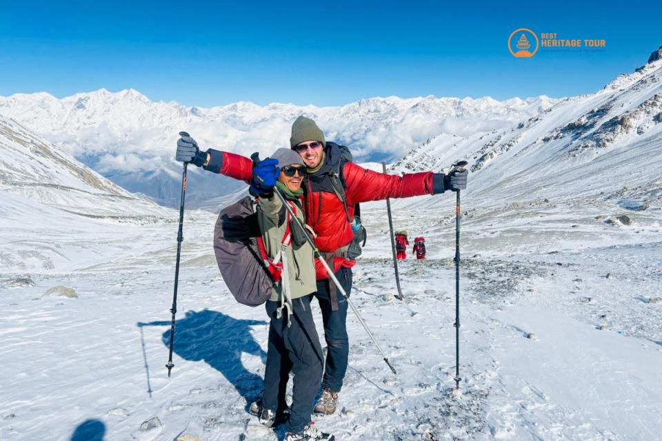
Crossing day is a test of stamina. Most groups start their trek at 3:30 AM to 4:00 AM from either Thorong Phedi (4,540 m) or High Camp (4,880 m). Starting in freezing, pitch-black darkness, you will ascend continuously for 3 to 5 hours over scree, loose rocks, and often packed snow to reach the pass summit.
3. The Punishing Knee-Jerk Descent
What goes up must come down - and in the case of Thorong La, the descent is often tougher on the body than the climb. After celebrating at the summit prayer flags, you face a brutal 1,600-meter vertical drop over roughly 10 kilometers down to Muktinath. This prolonged downhill section puts continuous stress on the knees, quads, and ankles.
4. Mountain Weather & High-Altitude Winds
The weather at 5,000 meters is notoriously fickle. By 11:00 AM, gale-force winds regularly sweep through the Thorong La gap. Early afternoon storms can drop temperatures well below freezing, bring sudden blizzards, or create whiteout conditions. This is precisely why our guides mandate early morning departures to cross the summit before wind speeds surge.
The 3 Phases of Crossing Thorong La Pass
To help visualize the day, our team breaks the crossing down into three distinct operational phases:
Phase 1: The Pre-Dawn Climb (High Camp to Summit)
-
Distance: ~5 km | Time: 3.5 to 5 hours | Terrain: Steep scree, snow patches, switchbacks
-
The Experience: Trudging uphill in freezing darkness with headlamps illuminated. Pacing is critical here - take slow, rhythmic, synchronized steps. False summits can test your mental fortitude, but continuing at a steady cadence brings the iconic, prayer-flag-draped tea house of Thorong La into view.
Phase 2: The Summit
-
Elevation: 5,416 meters (17,769 feet)
-
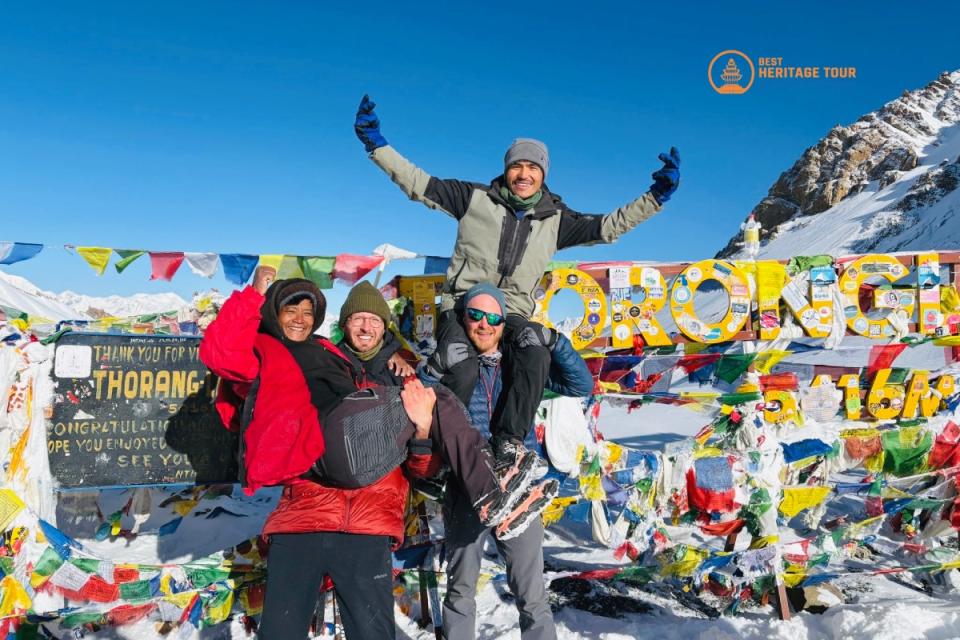
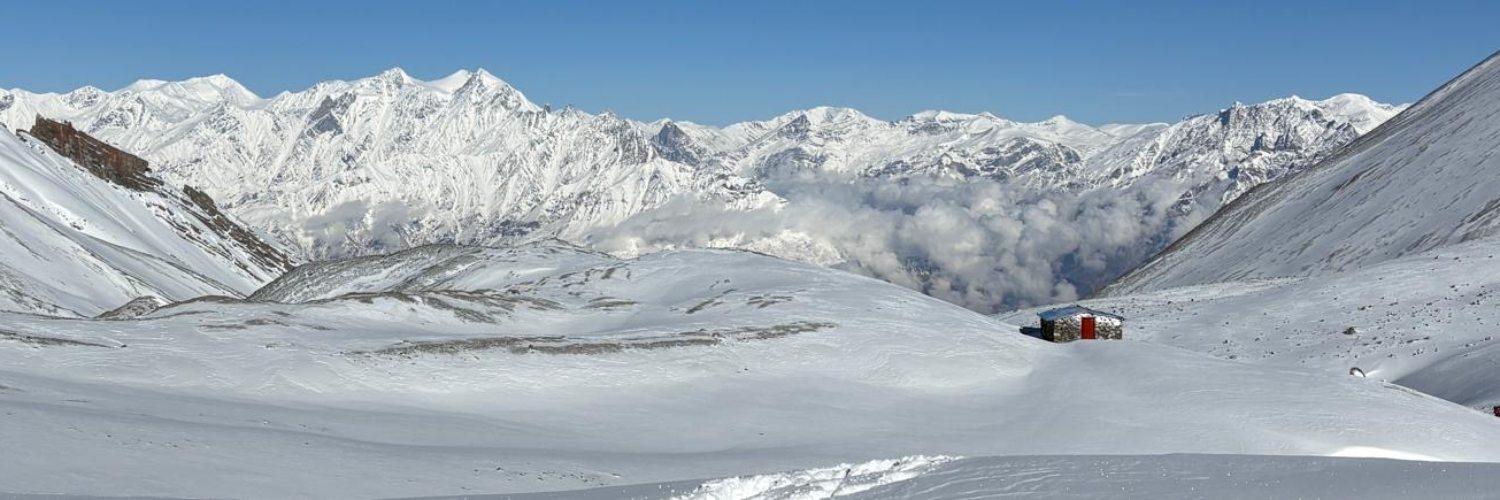
The Experience: Standing on top of the world with 360-degree views of the Annapurna Massif, Khatung Kang, Yakawa Kang, and the Dhaulagiri range. Due to extreme cold, high wind exposure, and thin air, we limit summit celebrations and photo stops to 15–20 minutes to prevent cold-related exposure.
Phase 3: The Long Descent to Muktinath
-
Distance: ~10 km | Time: 3.5 to 5 hours | Terrain: Steep gravel, loose shale, wind-blown dirt
-
The Experience: As you drop below 5,000 meters, breathing becomes noticeably easier, but physical fatigue sets in. Trekking poles are essential on this section to absorb impact on your joints. You eventually break out onto the arid plateau of Muktinath - a sacred pilgrimage center for both Hindus and Buddhists.
How to Prepare: Physical Fitness & Acclimatization
You do not need to be an elite athlete to conquer Thorong La, but you do need functional, real-world endurance.
Recommended Physical Training (Start 8-12 Weeks Prior)
-
Cardiovascular Base: Focus on low-intensity, long-duration cardio (running, cycling, rowing, swimming) 3 to 4 times a week to build lung efficiency.
-
Leg Strength & Eccentric Control: Incorporate weighted squats, lunges, step-ups, and calf raises. To prepare for the 1,600m descent, train on stair climbers or do weighted hill descents.
-
Loaded Trail Walking: Nothing replaces time on your feet. Practice hiking on natural, uneven terrain with a daypack weighing 6-8 kg.
The Golden Rules of Acclimatization
Proper acclimatization is the single greatest factor determining your success on Thorong La Pass. At Best Heritage Tour, our itineraries follow strict safety protocols:
-
Rest Day in Manang (3,540 m): Never skip the mandatory acclimatization day in Manang. Use this day for active acclimatization hikes (e.g., to Ice Lake or Gangapurna Lake viewpoint) following the "climb high, sleep low" principle.
-
Gradual Staging: We break the approach into manageable vertical gains - moving from Manang to Yak Kharka (4,010 m), then to Thorong Phedi (4,540 m) or High Camp (4,880 m).
-
Hydration & Nutrition: Drink 3 to 4 liters of fluid (water, electrolyte mixes, ginger tea) daily. Consume high-carbohydrate meals to keep energy reserves topped up.
Conclusion
So, how hard is it to cross Thorong La Pass? It is a formidable challenge that will test your legs, your lungs, and your mental drive. Yet, as you stand at 5,416 meters surrounded by flapping prayer flags and pristine snow-capped Himalayan giants, every step of the journey proves worthwhile. With the right physical prep, disciplined acclimatization, and seasoned local guides by your side, conquering Thorong La Pass is an bucket-list adventure waiting to happen.
Ready to test your limits on the iconic Annapurna Circuit? Let the local experts at Best Heritage Tour take care of your permits, itineraries, safety logistics, and guided arrangements.
Contact Best Heritage Tour
Phone / WhatsApp / Viber: +977-9851149197 / +977-9810043046
Email: info@bestheritagetour.com / bestheritagetour@gmail.com
Website: www.bestheritagetour.com
Office: Thamel Marg, Kathmandu, Nepal
Frequently Asked Questions
Is technical climbing gear required to cross Thorong La Pass?
No. Under standard spring and autumn conditions, Thorong La is a non-technical trekking pass. You do not need ice axes, ropes, or climbing harnesses. Sturdy trekking boots, warm layered clothing, and trekking poles are sufficient, though microspikes are recommended if ice or frozen snow is on the trail.
Can beginners with no high-altitude experience cross Thorong La?
Yes. Prior mountaineering experience is not required. Beginners with strong cardiovascular fitness, good leg endurance, and a properly structured itinerary with built-in acclimatization days (such as stopping in Manang) can successfully cross the pass.
Why do trekkers start the Thorong La Pass crossing pre-dawn?
To avoid dangerous high-altitude winds and afternoon weather shifts. Severe, gale-force winds consistently sweep through the 5,416m gap by mid-morning. Starting early ensures you cross the summit and descend to safer, lower elevations before temperatures drop and wind speeds peak.
What happens if a trekker gets Altitude Sickness (AMS) near the Thorong La Pass?
Immediate protocol takes over. Mild symptoms (headache, nausea) require stopping ascent, hydrating, and evaluating. If symptoms persist or worsen, the only cure is immediate descent. Our licensed guides monitor oxygen levels daily and coordinate emergency ground or helicopter evacuations if necessary.
Author: Best Heritage Tour
Date: 16th August, 2026