The Annapurna Circuit has long held a legendary status among global adventurers. Encircling the massive Annapurna Massif, this journey transitions from lush subtropical valleys and emerald terraced fields to high-altitude trans-Himalayan landscapes reminiscent of the Tibetan plateau. Crossing the iconic Thorong La Pass (5,416 m / 17,769 ft) and gazing over the sacred turquoise waters of Tilicho Lake remain bucket-list experiences for mountain lovers around the globe.
As infrastructure, road connectivity, and local mountain hospitality evolve across Nepal, planning your journey with up-to-date local intelligence is essential. At Best Heritage Tour, our team brings years of field experience in guiding mountain expeditions, managing high-altitude logistics, and crafting heritage journeys across the Himalayas.
Whether you are an ambitious hiker tackling your first Himalayan trek or a seasoned global traveler, this comprehensive guide covers everything you need to know about the Annapurna Circuit Trek Itinerary for 2027.
Annapurna Circuit Overview & 2027 Key Statistics
Before lacing up your boots, here is a quick snapshot of what to expect on this world-famous Himalayan traverse:
|
Trail Metric |
Fast-Facts & Details |
|---|---|
|
Trek Duration |
9 Days (Optimized Short Itinerary with Tilicho Lake) |
|
Maximum Elevation |
Thorong La Pass - 5,416 m / 17,769 ft |
|
Secondary High Altitude |
Tilicho Lake - 4,920 m / 16,141 ft |
|
Trek Difficulty |
Strenuous / High Altitude (Requires good physical fitness) |
|
Best Seasons |
Spring (March to May) & Autumn (September to November) |
|
Start / Finish Points |
Kathmandu / Kathmandu (via Pokhara) |
|
Permits Required |
ACAP (Annapurna Conservation Area Permit) & TIMS Card |
|
Accommodation |
Traditional Teahouses / Mountain Lodges |
Why Trek the Annapurna Circuit in 2027?
Trekking trends in Nepal are continuously evolving. Modern road developments in the lower Manang and Mustang valleys have transformed how travelers approach the trail. While traditional treks previously stretched over three weeks, modern logistics allow trekkers to bypass dusty road sections and focus entirely on the dramatic high-altitude wilderness.
1. The High-Altitude Spark: Tilicho Lake
Rather than skipping directly to the pass, modern high-altitude itineraries now incorporate Tilicho Lake (4,920 m) - one of the highest glacial lakes in the world. Nestled under the towering Tilicho Peak, this side trip provides incredible alpine vistas and serves as a vital acclimatization boost before tackling Thorong La Pass.
2. Upgraded Mountain Teahouse Comforts
In 2027, hospitality along the main Manang circuit offers better amenities than ever before. Trekkers can look forward to cozy dining rooms heated by central stoves, improved solar hot showers, expanded Wi-Fi access, and varied dining menus blending local Thakali cuisine with international dishes.
3. Streamlined Transport Connections
With high-clearance four-wheel-drive vehicles operating between Kathmandu, Besisahar, and Chame, travelers save valuable days of lowland walking. You can now transition from the bustling streets of Kathmandu into deep alpine gorges in a single day.
Detailed 9-Day Annapurna Circuit Trek Itinerary for 2027
Our team at Best Heritage Tour has refined this high-yield, 9-day itinerary to deliver maximum scenery, cultural exposure, and safe altitude progression without compromising on core highlights.
Day 1: Drive from Kathmandu to Chame
-
Driving Distance/Time: ~210 km / 8 to 10 hours
-
Starting Elevation: 1,350 m / 4,450 ft
-
Ending Elevation: 2,710 m / 8,890 ft
-
Highlights: Scenic drive along the Trishuli and Marshyangdi rivers, waterfalls, transition into pine forests.
Your adventure begins early in the morning as our private high-clearance vehicle picks you up in Kathmandu. We leave the Kathmandu Valley and head west along the Prithvi Highway, following the rushing waters of the Trishuli River before turning north along the Marshyangdi River.
As we pass Besisahar, the landscape dramatically changes from terraced farmland to steep mountain gorges carved by glacial rivers. Continuing through mountain hamlets like Dharapani and Koto, we reach Chame, the administrative headquarters of the Manang District. The air turns crisp, and on clear evenings, you will catch your first magnificent views of Lamjung Himal and Annapurna II.
Day 2: Trek from Chame to Pisang
-
Trekking Distance/Time: ~13 km / 5 to 6 hours
-
Starting Elevation: 2,710 m / 8,890 ft
-
Ending Elevation: 3,115 m / 10,200 ft
-
Highlights: Paungda Danda rock face, apple orchards of Bhratang, dense pine and fir forests.
Leaving Chame, the trail winds through dense pine forests and crosses the Marshyangdi River over sturdy suspension bridges. We pass through Bhratang, a region famous for its sprawling high-altitude organic apple orchards - be sure to sample fresh local apple pie or hot apple cider here!
Beyond Bhratang, the valley opens up to reveal the magnificent Paungda Danda, an enormous curved rock slab rising over 1,500 meters above the riverbed, considered sacred by local communities. As we gain elevation, the landscape gradually shifts from damp alpine forest to drier, pine-scented woodlands. By afternoon, we arrive in Pisang, divided into Lower and Upper Pisang, offering panoramic vistas of Annapurna II and IV.
Day 3: Trek from Pisang to Manang
-
Trekking Distance/Time: ~15 km / 6 to 7 hours (via Upper Route)
-
Starting Elevation: 3,115 m / 10,200 ft
-
Ending Elevation: 3,540 m / 11,300 ft
-
Highlights: Upper Pisang/Ghyaru historic villages, sweeping views of Annapurna Massif, Tibetan-style monasteries.
Today’s trek is one of the most scenic days on the entire trail. We recommend taking the upper route via Ghyaru and Ngawal. Although it involves a steep climb in the morning, the rewards are unmatched: uninterrupted, eye-level panoramas of Annapurna III, Annapurna IV, Gangapurna, and Tilicho Peak.
The architecture here is distinctly Tibetan-influenced, featuring flat-roofed stone houses, fluttering prayer flags, ancient chortens, and long mani walls inscribed with sacred mantras. Down in the valley, the terrain grows drier as we enter the rain-shadow zone of the Himalayas. We reach Manang, the primary cultural hub of the upper valley, where we rest and prepare for the higher altitude days ahead.
Day 4: Trek from Manang to Tilicho Base Camp
-
Trekking Distance/Time: ~16 km / 6 to 7 hours
-
Starting Elevation: 3,540 m / 11,300 ft
-
Ending Elevation: 4,150 m / 13,615 ft
-
Highlights: Khangsar village, dramatic landslide zones, rugged alpine wilderness.
From Manang, we diverge from the main Thorong La trail and branch west toward the remote Tilicho Lake valley. We pass through the historic village of Khangsar, known for its traditional stone architecture and Tibetan Buddhist monastery.
The trail beyond Khangsar winds past the monastery at Tare Gumba before reaching the famous landslide section - a narrow path traverse carved across steep scree slopes and unique rock formations created by millennia of glacial erosion. Moving steadily and cautiously through this surreal landscape, we reach Tilicho Base Camp, tucked beneath giant rock walls and hanging glaciers.
Day 5: Excursion to Tilicho Lake (4,920 m) & Trek to Shree Kharka
-
Trekking Distance/Time: ~14 km / 6 to 7 hours total
-
Base Camp to Lake: 3 to 4 hours uphill climb
-
Maximum Elevation: 4,920 m / 16,141 ft
-
Ending Elevation: 4,070 m / 13,350 ft (Shree Kharka)
-
Highlights: Majestic turquoise waters of Tilicho Lake, high-altitude glacial basin, panoramic views of Tilicho Peak.
We begin before dawn (around 4:30 AM or 5:00 AM) to avoid high winds that frequently sweep across the lake basin later in the morning. The climb to Tilicho Lake is steep and relentless, ascending series of switchbacks over moraine ridge lines.
As you top the final crest, the breathtaking sight of Tilicho Lake unfolds before you. Sitting at an altitude of 4,920 meters, its vibrant turquoise waters are fed directly by the glaciers of Tilicho Peak (7,134 m). After taking time to capture photos, savor the mountain silence, and enjoy hot tea at the seasonal lake lodge, we descend back to Tilicho Base Camp for lunch. In the afternoon, we make a gentle trek back to Shree Kharka for our overnight stay.
Day 6: Trek from Shree Kharka to Thorong Phedi
-
Trekking Distance/Time: ~13 km / 5 to 6 hours
-
Starting Elevation: 4,070 m / 13,350 ft
-
Ending Elevation: 4,500 m / 14,763 ft
-
Highlights: Rejoining the main circuit, panoramic views of Gundang Himal and Syagang, alpine tundra.
Leaving Shree Kharka, we walk along an upper trail that bypasses the lower valley and rejoins the primary Annapurna Circuit trail near Ledar. The vegetation drops away, replaced by sparse alpine scrub, open pastures where blue sheep (Bharal) often graze, and bare glacial stone.
We cross the Jarsang Khola over a wooden bridge and climb gradually toward Thorong Phedi (4,500 m), situated at the base of the pass. For well-acclimatized trekkers, an optional 45-minute climb leads up to High Camp (4,850 m). However, resting at Thorong Phedi ensures a better night's sleep before the big pass day. We have an early dinner and prepare our gear for the midnight wake-up call.
Day 7: Trek from Thorong Phedi over Thorong La Pass (5,416 m) to Muktinath
-
Trekking Distance/Time: ~16 km / 8 to 10 hours
-
Maximum Elevation: 5,416 m / 17,769 ft (Thorong La Pass)
-
Ending Elevation: 3,802 m / 12,473 ft (Muktinath)
-
Highlights: Successful crossing of one of the world's highest trekking passes, panoramic views of Dhaulagiri and Mustang, sacred temple complex of Muktinath.
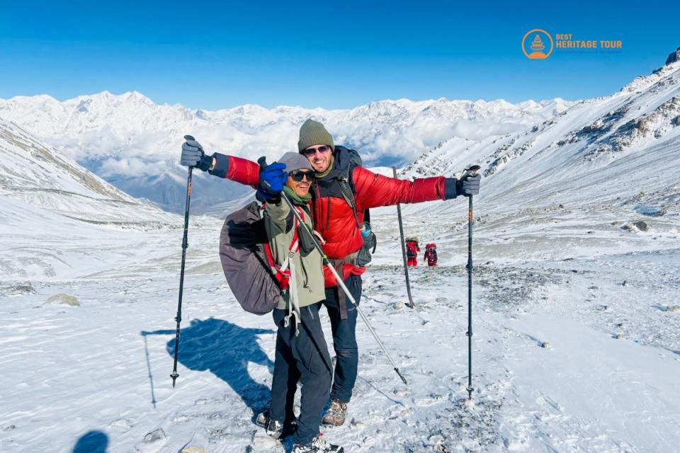
This is the defining day of the trek. We awake around 3:00 AM, equip our headlamps, drink warm tea, and hit the trail under a canopy of stars. The trail climbs steeply from Phedi to High Camp and continues up a long glacial valley toward the pass. The ascent requires a slow, steady, rhythmic pace to manage the thin air.
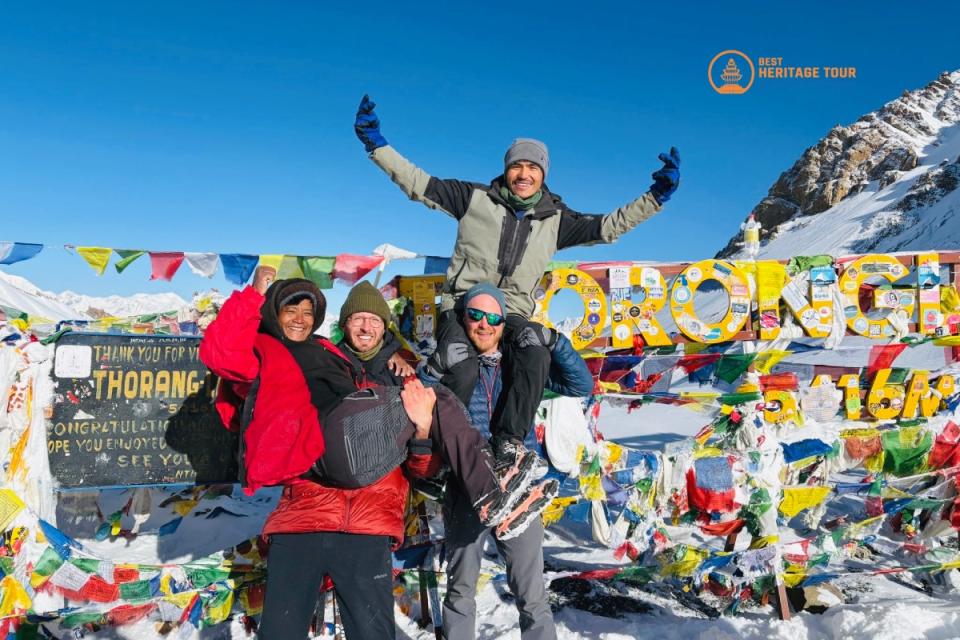
After 4 to 5 hours of uphill trekking, colorful prayer flags appear through the cold morning haze - you have reached Thorong La Pass (5,416 m)! Standing on top of the pass with sweeping views extending west to the Dhaulagiri range and north into the forbidden kingdom of Upper Mustang is an unforgettable triumph.
After celebrating and taking photos, we begin a long descent of roughly 1,600 vertical meters. The landscape transforms into the arid, desert-like hills of the Mustang region. By mid-afternoon, we arrive in Muktinath, a sacred pilgrimage site revered by both Hindus and Buddhists.
Day 8: Drive from Muktinath to Pokhara via Jomsom & Tatopani
-
Driving Distance/Time: ~175 km / 7 to 8 hours
-
Starting Elevation: 3,802 m / 12,473 ft
-
Ending Elevation: 850 m / 2,788 ft
-
Highlights: Kali Gandaki Gorge (world's deepest gorge), transition from Mustang desert to lush tropical valleys, Lakeside Pokhara relaxations.
In the morning, you can visit the sacred Muktinath Temple, famous for its 108 water spouts and eternal natural gas flames. Afterward, we board our vehicle for a scenic drive down the Kali Gandaki River valley.
We pass through Jomsom, famous for its mountain airstrip and local apple products, and continue through Marpha and Tatopani. The road carves between two massive 8,000-meter peaks - Annapurna I and Dhaulagiri - creating the Kali Gandaki Gorge, recognized as the deepest gorge on Earth. By evening, we arrive in the relaxing lakeside city of Pokhara. You can unwind with a hot shower, fine dining, and a stroll along Phewa Lake.
Day 9: Drive from Pokhara back to Kathmandu
-
Driving Distance/Time: ~200 km / 6 to 7 hours
-
Starting Elevation: 850 m / 2,788 ft
-
Ending Elevation: 1,350 m / 4,450 ft
-
Highlights: Scenic highway travel across central hill landscapes, river valleys, return to the capital.
After a relaxing morning in Pokhara, we head back toward Kathmandu along the highway (or optionally take a short 25-minute flight). As the green hills roll past, you will have time to reflect on the mountain pass crossed, high lakes visited, and remote villages explored. We arrive in Kathmandu by late afternoon, concluding your Himalayan journey.
Conclusion
Every journey through the Himalayas is more than just a physical trek - it is an immersion into ancient mountain cultures, serene landscapes, and lifelong memories. Designing a safe, seamless, and deeply enriching trek requires local knowledge, dependable field management, and genuine passion for high-altitude hospitality.
At Best Heritage Tour, our team brings years of field experience in organizing heritage cultural tours, high-altitude treks, and custom expeditions across Nepal. From managing permits and private ground transport to assigning certified, English-speaking mountain guides and porters, we handle every detail so you can focus on the path ahead.
Ready to Cross Thorong La Pass in 2027?
Let our team customize your dream itinerary, handle all local logistics, and ensure an unforgettable adventure through the heart of the Annapurna region.
Phone / WhatsApp / Viber: +977-9851149197 / +977-9810043046
Email: info@bestheritagetour.com / bestheritagetour@gmail.com
Website: www.bestheritagetour.com
Office: Thamel Marg, Kathmandu, Nepal
Author: Best Heritage Tour
Date: 7th October, 2026