Guide for Crossing the Larkya La Pass Safely
Conquering the Manaslu Circuit is often hailed as one of the ultimate achievements in Himalayan trekking. At the heart of this wild, restricted region lies its absolute crux: Larkya La Pass. Sitting at a formidable 5,106 meters (16,752 feet) above sea level, it stands as one of the longest and most demanding high-altitude passes in Nepal.
While the rewards of this trek are monumental - unrivaled, 360-degree vistas of the Mount Manaslu massif (8,163m), Himlung Himal (7,126m), Cheo Himal, and Annapurna II (7,937m) - the pass is a high-altitude arena that demands deep respect, flawless preparation, and expert strategy.
At Best Heritage Tour, we have guided hundreds of international adventurers across this frozen ridge. We know every rock, every glacier crevice, and every atmospheric shift on this trail. This comprehensive masterclass delivers our collective field experience directly to you, providing everything you need to know about how to cross the Larkya La Pass safely.
Is Crossing Larkya La Pass Very Difficult?
This is the most common question our team receives at our office. To answer honestly: yes, crossing Larkya La Pass is highly challenging, but it is entirely achievable for well-prepared trekkers.
The pass is not a technical climb. You do not need ropes, ice axes, or mountaineering harnesses. It is, fundamentally, a long, high-altitude walk. However, its difficulty stems from three distinct compounding factors:
-
The Thin Air Environment: Above 4,000 meters, every breath contains significantly less oxygen than at sea level. At the summit of 5,106 meters, your body operates under immense physiological stress.
-
The Extreme Endurance Demand: Pass day is an absolute marathon. You will be on your feet for anywhere between 8 to 11 hours, navigating freezing pre-dawn temperatures, loose moraine, and steep descents.
-
Unpredictable High-Mountain Weather: The weather at 5,000 meters can change in minutes. High-altitude winds routinely scour the pass in the afternoon, and sudden snowstorms can obscure the trail entirely.
For individuals with solid cardiovascular fitness, previous trekking experience above 3,500 meters (such as Everest Base Camp or the Annapurna Circuit), and an ironclad acclimatization schedule, the pass transitions from a dangerous obstacle into an exhilarating, life-changing milestone.
The Crux: How Is the Trail Like from Dharmasala to Bhimthang?
To understand the sheer scale of the pass day, you must break down the geography of the trail. This specific section of the Manaslu Circuit is a journey across two entirely different alpine worlds. You will begin the day in the dry, barren stone landscapes of the Gorkha district and end it in the lush, glacier-fed meadows of the Manang district.
The Breakdown of Pass Day
|
Segment |
Elevation Metrics |
Average Duration |
Terrain Type |
|---|---|---|---|
|
Dharmasala to Larkya Top |
4,460m to 5,106m (+646m gain) |
4 to 5 Hours |
Glacial moraine, frozen scree, packed snow/ice |
|
Larkya Top to Bhimthang |
5,106m to 3,720m (-1,386m loss) |
4 to 6 Hours |
Steep scree slopes, lateral moraines, rocky steps |
Part 1: The Cold Ascent (Dharmasala to Larkya Summit)
Your day begins in total darkness. The wake-up call at Dharmasala (Larkya Phedi) comes at 3:00 AM. Stepping out of your stone hut or shared tent, you will be met by sub-zero winds and a sky thick with stars.
Leaving camp by the beam of your headlamp, the trail immediately heads north, skirting the edge of the lateral moraine of the Larkya Glacier. The path is a steady, unforgiving incline over frozen dirt and loose rock. The absolute darkness shrinks your world down to the two steps directly in front of you.
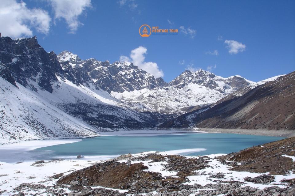
As dawn breaks, the trail flattens out temporarily into a series of frozen glacial basins. You will pass four frozen lakes, their surfaces glistening like mirrors in the early light. The final hour before the summit involves navigating a series of steep, switchbacking ridges over rocky moraine. Here, the air feels remarkably thin. Every step requires a conscious inhalation.
When you see the long string of colorful Tibetan prayer flags fluttering wildly against the deep blue sky, you know you have arrived. The summit reveals a staggering panorama: the massive wall of Cheo Himal, the sharp tooth of Kang Guru, and the immense, white bulk of Annapurna II.
Part 2: The Brutal Descent (Larkya Summit to Bhimthang)
Many trekkers assume reaching the top is the hard part, but our guides will tell you that the descent is where the real physical toll is extracted.
Immediately after celebrating at the pass, you face a massive 1,386-meter drop down to the Bhimthang valley. The initial descent is incredibly steep. The trail drops down a series of loose scree switchbacks that hug the edge of the mountain wall. If you are trekking in the spring or late autumn, this entire section can be covered in a slick sheet of hard-packed ice or hidden snow pockets.
As the trail drops below 4,500 meters, the angle softens. You enter the lateral moraine of the Bimthang glacier, walking along a high ridge with spectacular views of the melting ice and glacial rivers below. Your knees and quadriceps will be burning by the time the wide, grassy plateau of Bhimthang (3,720m) finally comes into view. Arriving at your teahouse in the afternoon, wrapping your cold hands around a steaming mug of ginger tea, the sense of relief and accomplishment is unparalleled.
Critical Things to Consider While Crossing the Larkya La Pass
Safety in the high Himalayas is never a matter of luck; it is a matter of strict adherence to proven mountain protocols. Through our decades of operating regional heritage tours, our team has established five non-negotiable pillars for a safe crossing.
1. Acclimatization is Non-Negotiable
You cannot rush the Manaslu Circuit. To ensure your body adapts to the thin air, a safe itinerary must feature built-in acclimatization milestones before you reach the base of the pass.
-
The Samagaun Standard: At 3,520 meters, Samagaun is the ideal location for a mandatory rest day. Our itineraries utilize this day for an active acclimatization hike up to Birendra Tal (Glacial Lake) or the high ridges towards Manaslu Base Camp (4,800m). This follows the classic mountaineering rule: climb high, sleep low.
-
The Samdo Buffer: At 3,875 meters, Samdo serves as your final springboard. Spending an extra night here or taking a short, slow hike toward the Tibetan border helps lock in your red blood cell production before you step into the extreme zone above 4,500 meters.
2. Acute Mountain Sickness (AMS) Protocol
At 5,000 meters, ignoring your body can lead to severe health complications. Every trekker must understand how to read the early warning signs of AMS.
-
Mild Symptoms: Mild headache, slight dizziness, loss of appetite, fatigue, or trouble sleeping. These are common signs that your body is working hard to adapt.
-
Actionable Response: If symptoms occur at Samdo or Dharmasala, you must communicate openly with your guide. We closely monitor our clients' oxygen saturation levels using pulse oximeters every single evening.
-
The Golden Rule of the Mountains: Never ascend with ascending symptoms. If a headache or nausea worsens despite rest and hydration, the only cure is immediate descent to a lower elevation.
3. Hydration and Fuel Dynamics
In the dry, freezing air of high altitudes, your body loses moisture at twice the rate of sea level through respiration alone. Dehydration mimics and accelerates the symptoms of altitude sickness.
-
Liquid Intake: Aim to drink between 4 to 5 liters of fluid daily once you pass Namrung (2,630m). This can be a combination of clean water, electrolyte solutions, garlic soup, and warm herbal teas.
-
The Water Temperature Problem: Standard plastic water bottles will freeze solid within two hours of leaving Dharmasala at 3:00 AM. You must carry insulated flasks or wrap your water bottles inside thick woolen socks inside your daypack.
-
Caloric Dense Energy: High altitude suppresses appetite, but your body burns immense energy just trying to stay warm. Keep high-protein energy bars, nuts, dried fruits, and chocolates in your jacket pockets for easy access during quick trail breaks.
4. Seasonal Windows and Daily Timing
The seasonal timing of your trek dictates the trail conditions you will encounter.
-
Autumn (September to November): This is the gold-standard season. The monsoon rains have washed the sky clean, leaving crystal-clear visibility and highly stable morning weather. October offers the absolute best balance of clear skies and manageable temperatures.
-
Spring (March to May): A spectacular time to visit as the lower rhododendron forests burst into vibrant reds and pinks. However, the high pass retains a significant accumulation of winter snow, making the trail more physically demanding.
-
The Dawn Rule: Regardless of the season, you must cross the summit before noon. By 1:00 PM, the pass routinely becomes a wind tunnel, with high-velocity gales blowing up from the Marsyangdi valley, drastically reducing temperatures and creating dangerous wind-chill factors.
Conclusion
Crossing the Larkya La Pass safely is an achievable dream that rewards you with memories to last a lifetime. By respecting the altitude, packing the right gear, tracking your physical health, and partnering with an experienced, authorized local team, you can confidently navigate this legendary Himalayan pass.
Planning your next great adventure into the heart of Nepal's heritage? Let our family take care of yours.
Reach Out to Best Heritage Tour
Phone / WhatsApp / Viber: +977-9851149197 / +977-9810043046
Email: [email protected] / [email protected]
Website: www.bestheritagetour.com
Office: Thamel Marg, Kathmandu, Nepal