All About Kang La Pass
For seasoned trekkers, finding a trail in the Himalayas that balances dramatic alpine landscapes with untouched cultural heritage can feel like searching for a hidden sanctuary. While the classic Annapurna Circuit remains a global icon, the modern adventurer often looks for something more remote. Tucked away north of the Marsyangdi River lies the ultimate answer: the raw, windswept, and deeply mystical Nar Phu Valley Trek.
At the structural and spiritual heart of this off-the-beaten-path journey sits the formidable Kang La Pass. This high-altitude gateway bridges the isolated, Tibetan-influenced valleys of Nar and Phu with the vibrant, classic trekking trails of Manang.
As a local travel agency - Best Heritage Tour, we have guided hundreds of international travelers through these restricted borderlands. We know that crossing this pass is not merely a high-altitude hike; it is an expedition into a living museum of Tibetan Buddhist culture. Here is our definitive insider guide containing all about the Kang La Pass Trek, designed to prepare you for one of the most rewarding high-altitude traverses in Nepal.
Where is Kang La Pass? Mapping the Hidden Corridor
To understand the geographical allure of this region, you must first ask: Where is Kang La Pass?
Administratively located within the Manang District of the Gandaki Province, the Kang La Pass serves as a natural alpine bridge. It divides the hidden valleys of Nar and Phu from the main Annapurna region. While the classic Annapurna trail marches west toward Thorong La, the route to Kang La branches sharply north from the small mountain outpost of Koto.
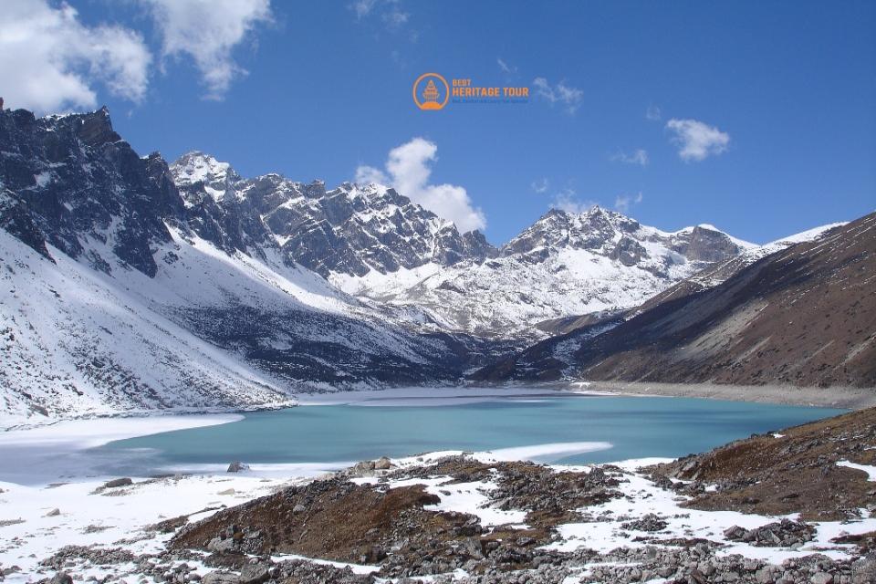
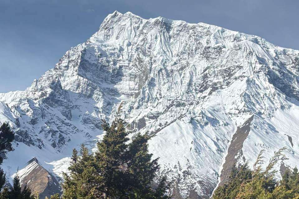
The pass sits nestled deep within the rain-shadow area behind the massifs of the northern Himalayas. This unique positioning means that while the southern slopes of Nepal experience heavy summer monsoons, the terrain surrounding the pass remains a stark, dramatic, and arid alpine desert - closely mimicking the topography of the Tibetan Plateau. The pass marks the transition where you leave behind medieval stone villages and ascend directly into a world of fractured glaciers and towering vertical rock.
Technical Specifications: Altitude and Geography
When preparing for this trek, the first question our guides receive is invariably about the physical scale of the mountain. What is the Altitude of Kang La Pass?
Official Elevation: The pass tops out at an impressive 5,320 meters (17,454 feet) above sea level.
To put this elevation into perspective, standing at the apex of Kang La puts you higher than Everest Base Camp (5,364 m) and just slightly lower than the nearby Thorong La Pass (5,416 m).
The geographical transition over the pass is steep and demanding:
-
The Ascent: You begin your pass day from the stone-paved alleys of Nar Village, situated at 4,110 m (13,484 ft). This means you will face a rigorous climb of $1,210$ vertical meters to reach the crest.
-
The Topography: The trail transitions from high-altitude alpine pastures (Jhombu Kharka) into a world of steep, loose screed, moraines, and narrow switchbacks that require steady footing and deliberate pacing.
-
The Descent: Once you cross the prayer-flag-draped spine of the pass, the trail drops sharply by more than 1,600 vertical meters down to the historical village of Ngwal (3,660 m), offering an immediate shift in climate, oxygen density, and landscape.
Trekking Difficulty, Fitness, and Preparation
The pass is categorized by our mountain experts as a strenuous, high-altitude alpine pass. It is substantially more demanding than the standard paths found on the Everest Base Camp or Annapurna Sanctuary routes.
Why it is Challenging:
-
The Altitude Jump: You will be spending multiple consecutive days sleeping above 4,000 meters before pushing past 5,300 meters. The risk of Acute Mountain Sickness (AMS) is real, which is why our itineraries explicitly prohibit rushed ascents.
-
The Steep, Variable Terrain: The final 300 vertical meters to the pass often present snow, patches of ice, and loose scree. Good balance, ankle support, and specialized footwear are mandatory.
-
The Long Endurance Day: Pass day requires up to 10 hours of intense physical exertion. Your legs must be prepared for a steep descent that can strain your knees.
Recommended Training Regime
To ensure an enjoyable and safe journey, we highly recommend starting a targeted physical training cycle at least 8 to 12 weeks before departure:
-
Cardiovascular Conditioning: Focus on high-incline treadmill walking, stair climbing, and long-distance running. Aim for 45-60 minutes of zone 2 cardio 4 times a week.
-
Leg Strength & Core Stability: Incorporate weighted squats, lunges, step-ups, and planks to prepare your muscles for the heavy impact of the long descent into Ngwal.
-
Real-World Hiking: Whenever possible, take weekend treks wearing a loaded backpack (8-10 kg) to break in your trekking boots and condition your shoulders.
Required Permits and Local Regulations
Because the Nar Phu Valley sits directly alongside the border with the Tibet Autonomous Region of China, the Government of Nepal maintains strict environmental and cultural protections over the area. Independent trekking is strictly illegal here. From 2026 restricted area permit update, solo travelers permit is allowed but must be authorized by licensed agency like us and accompanied by a certified guide.
|
Permit Type |
Cost (Sept-Nov) |
Cost (Dec-Aug) |
Purpose |
|---|---|---|---|
|
Nar Phu Restricted Area Permit (RAP) |
USD 100 per person / week |
USD 75 per person / week |
Grants access past the Koto checkpoint into the border valley |
|
Annapurna Conservation Area Project (ACAP) |
NPR 3,000 (~USD 23) |
NPR 3,000 (~USD 23) |
Supports conservation and trail maintenance across the wider region |
Essential Packing List for High Altitude
Packing for a restricted area trek requires an exact balance between warmth and weight. There are no gear shops once you pass Koto, meaning your pack must contain everything required to withstand sub-zero conditions on the high pass.
1. Footwear & Trail Gear
-
Broken-in, waterproof, high-ankle trekking boots.
-
4 pairs of heavy-weight merino wool trekking socks.
-
Lightweight, adjustable aluminum trekking poles (vital for saving your knees during the steep descent from the pass).
-
Lightweight, packable slip-on microspikes (essential if early spring or late autumn snow sits on the pass switchbacks).
2. Layering System (Temperatures can drop to -15°C / 5°F on the pass)
-
Base Layer: 2 pairs of moisture-wicking merino wool thermal tops and bottoms.
-
Mid Layer: A breathable fleece jacket or lightweight synthetic active insulation jacket.
-
Outer Shell: A windproof, waterproof Gore-Tex jacket and rain pants.
-
Insulation Layer: A high-loft down jacket with a minimum of 800 fill power (essential for cold evenings in the teahouses).
3. Safety, Hydration, and Electronics
-
A high-quality UV water purifier or water purification tablets (we discourage the purchase of single-use plastic bottles in these fragile eco-systems).
-
Two 1-liter wide-mouth insulated water bottles.
-
A high-capacity power bank ($20,000\text{ mAh}$ or greater), as solar charging costs extra in remote valleys.
-
A personal medical kit containing Diamox (for altitude acclimatization), blister pads, rehydration salts, and broad-spectrum antibiotics.
Conclusion
The crossing of the Kang La Pass is more than just a pin on a map; it is a profound journey through time, culture, and some of the most striking alpine geography on earth. To safely navigate this restricted wilderness, you need more than just a map - you need the deep, multi-generational expertise of local guides who speak the local dialects, understand the subtle shifts in high-altitude weather, and hold deep relationships with the families running the remote teahouses.
At Best Heritage Tour, we pride ourselves on delivering highly personalized, safety-first expeditions that respect both the local communities and the raw power of the mountains. Our experienced guiding crews are fully equipped, medically certified, and deeply committed to showing you the authentic soul of Nepal.
Let us handle the permits, logisitics, and safety protocols while you focus on taking the journey of a lifetime.
Contact Our Travel Experts Today
Phone / WhatsApp / Viber: +977-9851149197 / +977-9810043046
Email: [email protected] / [email protected]
Website: www.bestheritagetour.com
Office: Thamel Marg, Kathmandu, Nepal
Frequently Asked Questions (FAQ)
Can a beginner trekker cross the Kang La Pass?
While highly fit and determined beginners can successfully complete this route, we generally recommend having at least one prior high-altitude trek under your belt (such as Langtang Valley or Mardi Himal). The remoteness of the valley and the steepness of the pass require confidence on rugged mountain paths.
Is electricity and Wi-Fi available throughout the Nar Phu Valley Trek?
Electricity for charging devices via solar panels is available in most villages, though teahouses charge a small fee (2-5 USD). Wi-Fi is extremely limited, slow, and completely non-existent once you move past Koto into Meta, Phu, and Nar. Treat this trek as a welcome digital detox.
What is the food and accommodation like in the hidden valley?
Accommodations are simple, authentic, locally-run teahouses. Rooms are generally twin-sharing with shared, external bathrooms. The food is fresh, organic, and fuel-heavy - consisting of traditional Dal Bhat (lentil soup, rice, and vegetable curry), garlic soups (excellent for altitude), pasta, and Tibetan fried breads.
When is the absolute best season to tackle the Kang La Pass?
The premier windows are Autumn (September to November) and Spring (March to May). During these months, the weather is stable, the skies are crystal clear, and the pass is usually clear of dangerous winter snow drifts. Because the valley sits in a rain shadow, it can also be trekked during the summer months, though the drive through the lower canyons can be delayed by monsoon rains.