Hidden deep within the restricted northern borders of the Gorkha District lies a legendary, yet vastly overlooked Himalayan geographic crossing: the Rui La Pass. Sitting at a breathtaking altitude of 4,998 meters (16,398 feet), this ancient, windswept mountain saddle marks the structural and political border stone between Nepal and Dzong Who (Tibet, China).
While thousands of international trekkers flock to the high alpine pastures of Upper Manaslu every year to conquer the famous Larkya La Pass (5,106m), only a tiny fraction of adventurers ever turn their eyes northward toward this spectacular Trans-Himalayan frontier.
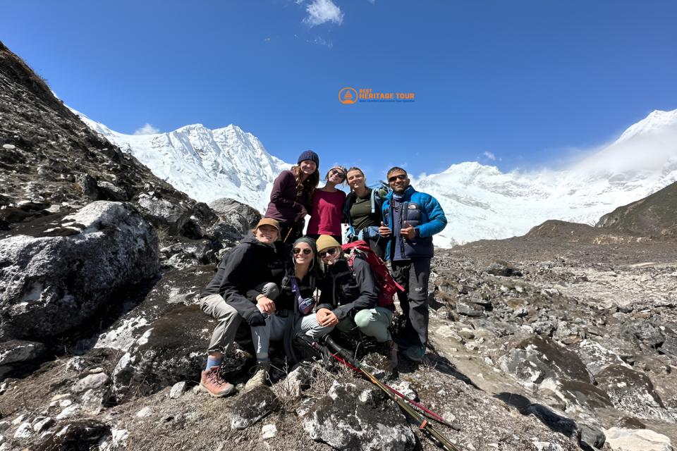
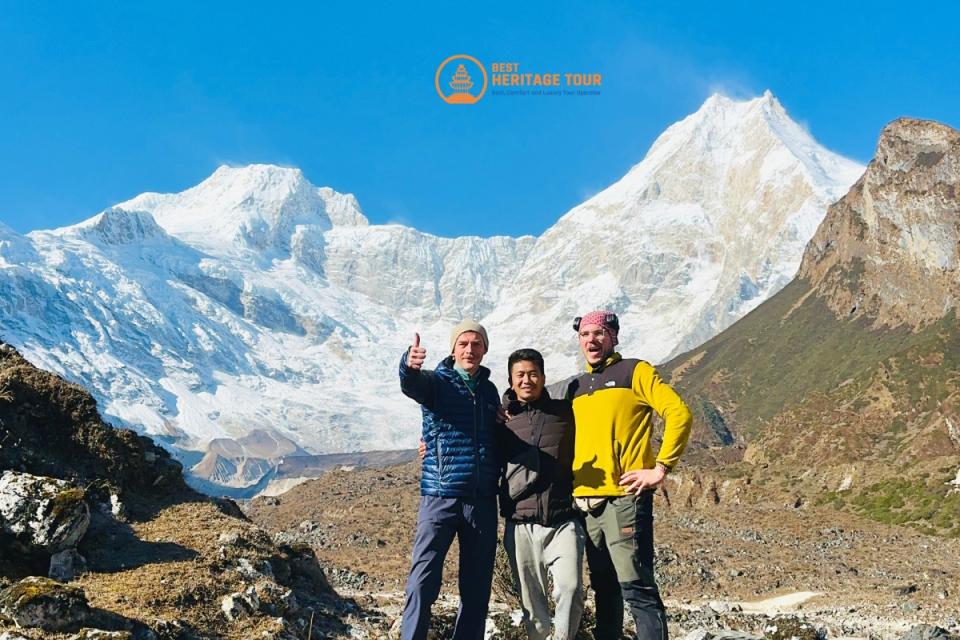
At Best Heritage Tour, we believe that true exploration lies just beyond the edges of the standard map. Our veteran local mountain guides have spent decades navigating the Nubri Valley, and we have watched far too many trekkers rush past one of the most culturally profound, visually arresting viewpoints in the entire Hindu-Kush Himalayan range.
This comprehensive guide is designed to provide you with absolute navigational and practical clarity on All about the Rui La Pass Trek. From exact geographic coordinates and acclimatization strategies to uncovering the mystery of why so many trekkers completely miss this life-changing detour, here is everything you need to know to execute the perfect high-altitude expedition.
Where is Rui La Pass Trek?
To understand the exact geography of the Rui La Pass Trek, one must look closely at the upper sub-alpine regions of the Manaslu Conservation Area Project (MCAP) in northern Nepal.
[Kathmandu] ➔ [Machha Khola] ➔ [Jagat] ➔ [Deng] ➔ [Namrung] ➔ [Sama Gaon] ➔ [Samdo (3,860m)] ➔
[Standard Route: Dharmasala ➔ Larkya La] or
[Detour: Rui La Pass (4,998m)]
The Geographic Blueprint
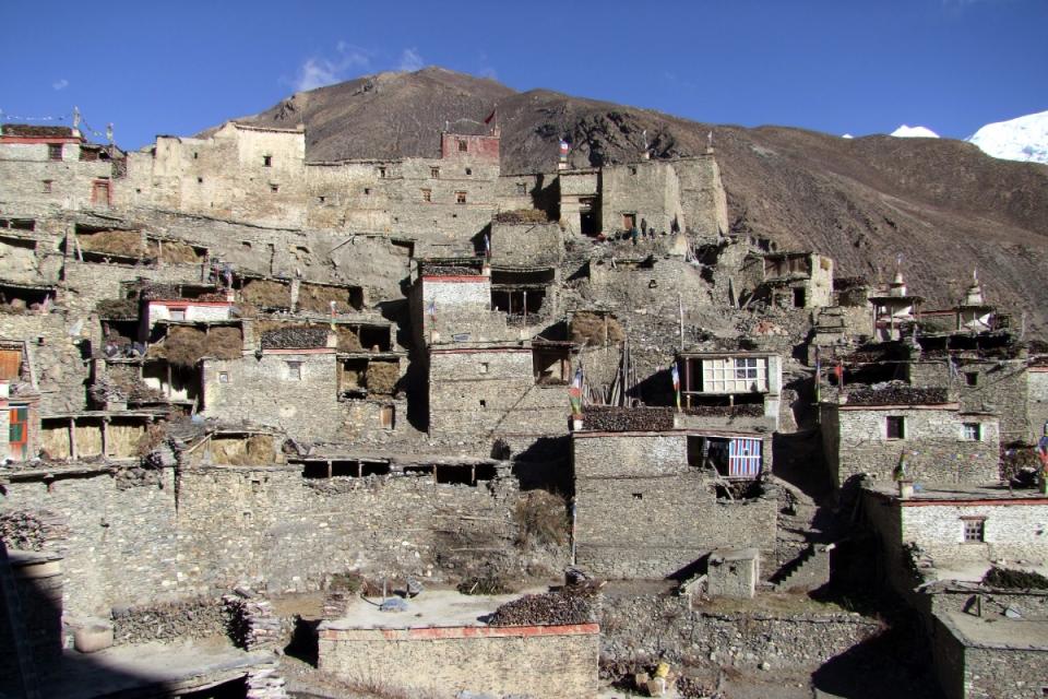
The pass itself is located directly north of Samdo Village (3,860m), the last true human settlement before the high barren pass of Larkya La. Samdo is an authentic, stone-built Tibetan-Buddhist settlement huddled at the base of the Samdo Peak. It is populated heavily by descendants of Tibetan refugees who crossed over decades ago, bringing with them their distinct language, architecture, and spiritual practices.
The trail to Rui La follows the ancient, classic "U"-shaped glacial valley carved out by centuries of ice movement. It snakes along the old salt-trading route that once connected the salt-flats of Tibet with the lowlands of the Budhi Gandaki River Valley.
Map & Boundary Realities
When you stand at the crest of Rui La Pass at 4,998 meters, you are standing on the literal edge of Nepal’s sovereignty. The boundary line is physically immortalized by a historic border pillar.
-
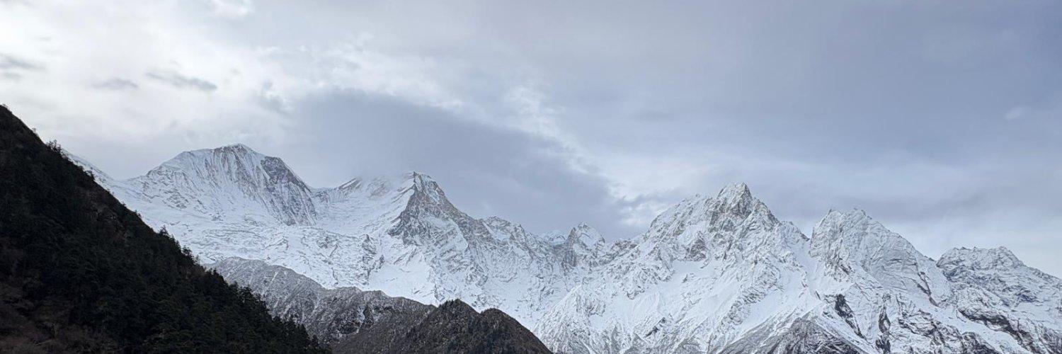
To the South: The towering, jagged, snow-capped giants of the Central Himalayas unfold before you - including the sheer north faces of Mount Manaslu (8,163m), Himalchuli, Simnang Himal, and Ngadi Chuli (Peak 29).
-
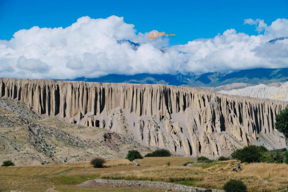
To the North: The world instantly shifts into an entirely different geological universe. The snow-draped peaks give way to the vast, arid, purple-and-ochre rolling plateaus of the Tibetan Trans-Himalaya. On clear days, you can easily look down with the naked eye into actual Tibetan villages, watching remote settlements dotting the high-altitude desert plains of China.
Why Many Miss the Rui La Pass (And Why You Cannot Miss It)
It is one of the ultimate ironies of trekking in Nepal: hundreds of trekkers sit in their tea houses in Samdo for a mandatory acclimatization day, staring at the walls, completely unaware that a pristine, historical gateway to Tibet is just a day-hike away.
But why many miss the Rui La Pass comes down to three major factors - all of which our team at Best Heritage Tour systematically resolves for our clients.
1. The Fixed Guide Mentality and Rigid Itineraries
The vast majority of standard, budget travel agencies sell a highly rushed, commercialized 12-to-14-day Manaslu Circuit itinerary. In these cookie-cutter itineraries, Day 13 or 14 is simply labeled as: "Trek from Sama Gaon to Samdo (3-4 hours), afternoon rest."
Because many independent or unattached freelance guides are eager to keep moving toward the strenuous crossing of Larkya La Pass to finish the trek on schedule, they rarely pitch or encourage the demanding 7-to-8-hour round-trip hike up to the Tibetan border.
2. Physical Exhaustion & Pre-Pass Anxiety
By the time trekkers reach Samdo at 3,860 meters, they have been walking uphill for over a week. The air is thinning significantly (atmospheric oxygen drops to roughly 63% of sea-level value here).
The sheer mental weight of the upcoming, intimidating Larkya La Pass (5,106m) causes many hikers to treat Samdo purely as a place to sleep, hide from the sub-zero winds, and conserve their physical energy. They mistake complete physical inactivity for proper high-altitude acclimatization.
3. Missing the Hidden Science: The Acclimatization Paradox
This is the single biggest operational mistake a trekker can make. Mountaineering medical science has proven time and again that the absolute best way to prepare your body for a massive altitude jump is to practice the golden rule: "Climb High, Sleep Low."
Sitting in a cold tea house dining room in Samdo all day doing nothing actually slows down your body's cardiovascular adaptation process. By embarking on a side trip to Rui La Pass, you are pushing your body up to the 4,998-meter threshold, exposing your lungs to thin air, and then immediately descending back to the safety of 3,860 meters to sleep.
The Expert Guide View: Trekkers who undertake the Rui La Pass side trip adapt significantly faster. When they tackle the formidable Larkya La Pass forty-eight hours later, their bodies have already processed the atmospheric pressure of 5,000 meters. For them, the main pass becomes an enjoyable walk rather than a grueling, hypoxic survival struggle.
Detailed Trail Logistics: Side Trip to Rui La Pass
If you choose to journey with Best Heritage Tour, this is exactly how your unforgettable day-hike to the Tibetan frontier will unfold.
The Morning Departure
The day begins in the freezing, crystal-clear twilight of Samdo. We wake up at 5:30 AM, enjoying a calorie-dense breakfast of hot Tibetan bread, eggs, and steaming ginger tea inside our lodge. By 6:30 AM, our team is on the trail. The early start is non-negotiable; high-altitude mountain passes are notorious for generating fierce, gale-force winds and localized cloud cover by midday.
The Ascent Through the Wild High Pastures
Leaving the stone chortens and fluttering prayer flags of Samdo behind, the trail heads directly north, bypassing the western route that leads to Dharmasala (Larkya Phedi). We walk along the wild, rugged banks of the upper Athahra Khola.
The terrain quickly transitions from alpine scrub into barren, rocky scree slopes and vast yak pastures. Keep your eyes sharp and your cameras ready: this specific, isolated corridor is a prime habitat for exotic Himalayan wildlife. It is incredibly common to spot herds of blue sheep (Bharal) grazing on the steep ridges, Himalayan marmots popping out of their underground burrows, and massive Himalayan griffons and lammergeiers soaring majestically on the thermal wind currents directly above.
Fossils and Sacred Geometry
As we push past the 4,500-meter mark, the valley takes on an almost spiritual, otherworldly atmosphere. The ground beneath your trekking boots holds an incredible secret: Countless ancient marine fossils (Shaligrams) are embedded directly into the loose shale and river stones.
For our Hindu guides and pilgrims, these ammonite fossils are not just geological remnants of the ancient Tethys Ocean that existed before the Himalayas erupted; they are revered as the literal, natural manifestations of Lord Vishnu. The sheer weight of walking over land considered deeply sacred by both Hindus and Tibetan Buddhists adds an undeniable layer of profound cultural mystique to every step you take.
Reaching the Border Crest (4,998m)
The final hour of the climb is a steady, rhythmic test of endurance over steep, windswept moraine. And then, suddenly, the grade flattens out, and you step onto the wide, open saddle of the pass.
A massive, vibrant explosion of colorful Tibetan prayer flags (Lungta) appears, lashed securely to rocks and border markers, whipping violently in the sub-zero wind. You have officially arrived at the Rui La Pass.
Practical Blueprint & Comparison Matrix
To help you visualize how this extraordinary side trip integrates seamlessly into your wider Manaslu Circuit adventure, our editorial team has compiled this quick-reference operational matrix:
|
Metric / Parameter |
The Main Event: |
The Hidden Gem: |
|---|---|---|
|
Official Altitude |
5,106 meters / 16,752 feet |
4,998 meters / 16,398 feet |
|
Primary Trek Role |
Mandatory Transit Pass (Connects Gorkha to Manang) |
Optional Acclimatization & Cultural Side Trip |
|
Starting Base Point |
Dharmasala / Larkya Phedi (4,460m) |
Samdo Village (3,860m) |
|
Average Duration |
8 to 10 hours (Point-to-Point to Bimthang) |
7 to 8 hours (Complete Round-Trip back to Samdo) |
|
Visual Reward |
Glacial icefalls, Larkya Peak, Annapurna II |
Unobstructed view of the barren Tibetan Plateau & Border Pillar |
|
Crowd Density |
High (Every trekker on the circuit must cross) |
Exceptionally Low (Raw, isolated, pristine wilderness) |
Crucial Travel Tips for a Safe Frontier Trek
Because the Rui La Pass Trek pushes you directly up to the 5,000-meter line, it demands respect, preparation, and expert logistical oversight. Here are the core safety and tactical rules our company enforces to guarantee a seamless trek:
-
Pack Severe Weather Gear: Even if the morning sun feels warm in Samdo, the temperature at the border can drop below freezing in minutes. Always carry a windproof/waterproof hardshell jacket, a thick down coat, insulated gloves, a thermal beanie, and UV-blocking polarized sunglasses to prevent snow blindness.
-
Hydration is Your Lifeline: The hyper-dry air and rapid breathing at 4,998 meters will dehydrate you twice as fast as sea-level walking. Carry at least 3 liters of water per person, insulated inside thermal flasks to prevent the water from freezing solid in your pack.
-
Check the Border Regulations: Because Rui La is a sensitive geopolitical border checkpoint between Nepal and China, access can occasionally be restricted by border patrol authorities based on real-time security protocols. Our team at Best Heritage Tour maintains direct communication with local authorities in Gorkha and Samdo, ensuring our clients have up-to-the-minute safety clearances before setting foot on the trail.
Conclusion
The Manaslu Circuit is undoubtedly one of the last remaining bastions of raw, authentic, off-the-beaten-path trekking in Nepal. But to truly experience its magic, you must be willing to step off the standard commercial track. Choosing to include the Side trip to Rui La Pass is the difference between simply completing a trek and embarking on a genuine, profound Himalayan expedition.
Standing at that ancient stone border pillar, surrounded by thousands of whispering prayer flags, looking simultaneously out over the snow peaks of Nepal and the endless, forbidden plains of Tibet, is a transformative moment that will stay etched in your soul forever. Do not let bad planning or a rushed itinerary rob you of this once-in-a-lifetime experience.
Book Your Authentic Journey Today! Contact Best Heritage Tour:
Phone / WhatsApp / Viber: +977-9851149197 / +977-9810043046
Email: info@bestheritagetour.com / bestheritagetour@gmail.com
Website: www.bestheritagetour.com
Office: Thamel Marg, Kathmandu, Nepal
Author: Best Heritage Tour
Date: 22nd May, 2026