At Best Heritage Tour, we often find that the first question most aspiring trekkers ask isn’t about the food or the gear - it’s about the distance. "How long is the Annapurna Circuit?" sounds like a simple enough question, but in the heart of the Himalayas, distance is a relative term.
Since we opened our doors, we’ve seen the Annapurna Circuit evolve. Once a 230-kilometer (143-mile) epic that required a solid month of walking, the modern trek has shifted due to road developments and new trail alternatives. In 2026, the distance you cover depends entirely on your spirit of adventure and the route you choose. Whether you are looking for the classic "full circle" or a condensed mountain highlight reel, understanding the miles beneath your boots is the first step to conquering the pass.
The Total Distance: By the Numbers
If you were to look at a map and trace the traditional horseshoe-shaped route starting at Besisahar and ending in Nayapul, the total distance fluctuates between 160 km and 230 km (100-145 miles).
Why the wide range? It’s because of the roads. Today, many trekkers choose to take a jeep through the lower, dusty sections of the Marsyangdi Valley to reach the higher, more scenic trails faster. Conversely, others take the "NATT" (Natural Annapurna Trekking Trails) which bypass the roads, adding miles but preserving the authentic trekking experience.
|
Trek Variant |
Approximate Distance |
Typical Duration |
|---|---|---|
|
The Full Classic Circuit |
210-230 km |
18-21 Days |
|
Modern Standard Circuit |
160-180 km |
12-15 Days |
|
Short Circuit (with Jeep/Flight) |
100-120 km |
10-12 Days |
|
Circuit + Tilicho Lake Add-on |
+40 km |
+3 Days |
Why Distance Isn't the Only Metric
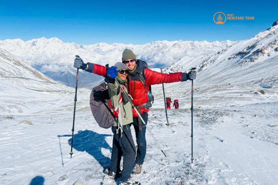
In the Annapurna region, a 10-kilometer day in the lowlands feels vastly different from a 10-kilometer day at 5,000 meters. As a heritage-focused travel company, we remind our guests that elevation gain is the "hidden distance."
When you cross the Thorong La Pass (5,416m), you aren't just moving forward; you are moving upward into a zone where oxygen is 50% thinner than at sea level. A single mile at this altitude can take as much energy as five miles in the valley.
Breaking Down the Miles: A Day-by-Day Journey
To give you a realistic "boots-on-the-ground" perspective, let’s look at the daily distances for a standard 14-day itinerary, which is what most of our international guests at Best Heritage Tour prefer.
Phase 1: The Jungle and The Gorge (The Ascent)
The trek begins in the lush, subtropical greenery of the Lamjung district. You’ll hear the roar of the Marsyangdi River and see waterfalls that look like they’ve fallen out of a storybook.
-
Day 1: Kathmandu to Dharapani (Drive)
-
Distance: 213 km drive.
-
Note: We skip the dusty road walks from Besisahar to give you more time in the high mountains.
-
-
Day 2: Dharapani to Chame
-
Distance: 15.5 km (9.6 miles)
-
Time: 5-6 hours
-
Highlight: Entering the pine forests and getting your first glimpse of Annapurna II.
-
-
Day 3: Chame to Upper Pisang
-
Distance: 13.2 km (8.2 miles)
-
Time: 5 hours
-
Highlight: The dramatic curved rock face of Paungda Danda - a massive slab of stone rising 1,500m above the trail.
-
Phase 2: The High Manang Valley (Acclimatization)
This is where the landscape shifts from green forests to a stark, Tibetan-influenced rain shadow. The distances get shorter, but the air gets thinner.
-
Day 4: Upper Pisang to Manang (via Ngawal)
-
Distance: 17 km (10.5 miles)
-
Time: 7 hours
-
Why this route? We take the "Upper Trail" through Ngawal. It's longer and harder than the valley floor route, but the panoramic views of the Annapurna massif are unparalleled.
-
-
Day 5: Rest and Acclimatization in Manang
-
Distance: 4-6 km (Side hikes)
-
Note: You don't move "forward" on the circuit today, but hiking to Gangapurna Lake or the Ice Lake is essential for your body to adjust to 3,500m+.
-
Phase 3: The Approach to Thorong La
The distances shrink significantly here as we move into the alpine tundra.
-
Day 6: Manang to Yak Kharka
-
Distance: 9.4 km (5.8 miles)
-
Time: 4 hours
-
Vibe: You are now above the tree line. Keep an eye out for Blue Sheep (Bharal) grazing on the slopes.
-
-
Day 7: Yak Kharka to Thorong Phedi
-
Distance: 7 km (4.3 miles)
-
Time: 3.5 hours
-
Note: It’s a short walk, but the goal is to rest. You are at the foot of the giant.
-
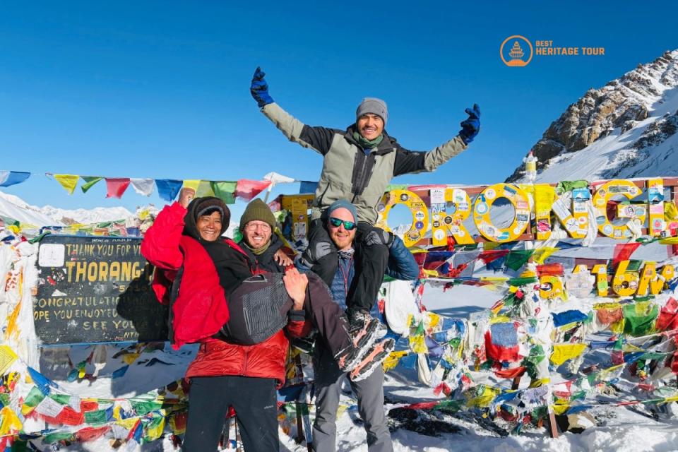
Phase 4: The Big Day (The Pass)
This is the longest and most challenging day of the trek.
-
Day 8: Thorong Phedi to Muktinath via Thorong La Pass
-
Distance: 16 km (9.9 miles)
-
Time: 8-10 hours
-
Elevation: You’ll climb nearly 1,000m to the pass (5,416m) and then descend 1,600m to the sacred temples of Muktinath.
-
Phase 5: The Kali Gandaki Valley (The Descent)
After the pass, the landscape changes again into a windswept, desert-like terrain.
-
Day 9: Muktinath to Jomsom
-
Distance: 18 km (11.1 miles)
-
Highlight: Walking through the medieval-looking village of Jharkot and the wide, flat bed of the Kali Gandaki River.
-
The "Road" Factor: Should You Walk or Drive?
One of the biggest debates in modern trekking is the road. Between 2010 and 2026, road access has reached as far as Manang on the east and well past Muktinath on the west.
At Best Heritage Tour, we believe in the "Best of Both Worlds" approach.
-
Don’t walk on the road: Walking on a road where jeeps kick up dust isn't "heritage trekking." We use NATT trails - community-managed paths that lead you through old villages and forests, far from the engines.
-
Strategic Driving: We use transport for the long, flat, or dusty sections (like the final stretch from Jomsom to Tatopani) to save your knees and focus your energy on the most pristine parts of the circuit.
Preparing Your Body for the Distance
You don't need to be an Olympic athlete to cover the 160+ kilometers of the Annapurna Circuit, but you do need "trekking legs."
-
Cardio is King: Start walking 3-4 months before your trip. Aim for 10-15 km walks on weekends with a weighted pack.
-
Strength Training: Focus on your quads, glutes, and core. The descent from the pass to Muktinath is a 1,600-meter knee-burner.
-
Mental Fortitude: Some days are long. The wind will blow in your face in the Kali Gandaki, and the uphill to the pass will feel endless. Mental stamina is just as important as physical distance.
Cultural Distance: What You See Between the Miles
Distance on the Annapurna Circuit isn't just measured in kilometers; it's measured in cultural shifts.
-
The Hindu Lowlands: You start among the Brahmins and Chhetris, passing terraced rice fields.
-
The Gurung Heartland: In the middle hills, you encounter the brave Gurung culture, famous for the British Gurkha soldiers.
-
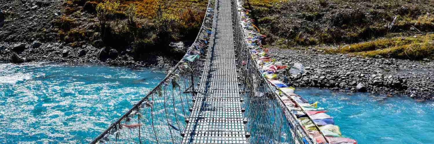
The Tibetan Plateau: In Manang and Mustang, the culture is purely Tibetan Buddhist. You’ll walk past Mani Walls (prayer stones) and Chortens that have stood for centuries.
Remember the golden rule of heritage trekking: Always walk to the left of a Mani wall.
Final Thoughts
The Annapurna Circuit is more than just a line on a GPS. It is a transition through life itself - from the heat of the tropics to the frozen silence of the high Himalayas. Whether you walk 160 km or the full 230 km, the distance you’ll remember most is the distance you traveled within yourself.
At Best Heritage Tour, we don't just guide you through the miles; we help you understand the stories, the people, and the heritage that make those miles meaningful.
Ready to start your journey? Let us handle the logistics, the permits, and the navigation while you focus on the horizon. The Annapurna Circuit is waiting for you in 2026.
Phone / WhatsApp / Viber: +977-9851149197 / +977-9810043046
Email: info@bestheritagetour.com / bestheritagetour@gmail.com
Website: www.bestheritagetour.com
Office: Thamel Marg, Kathmandu, Nepal
Author: Best Heritage Tour
Date: 21st January, 2026